
Bird’s-eye view – Long-tailed paradise-whydah
July 26, 2012Cycling across the desert – an adventure in Damaraland
July 26, 2012by Peter Bridgeford
“After about fourteen hours of fatiguing travel, we reached the small river Tincas [Tinkas], where we unyoked, and rested ourselves and the weary oxen until nightfall. We found it necessary to keep a sharp lookout, both on account of the wild beasts [lions and rhinos], and fear of losing our way. The latter was particularly to be guarded against; for, in this land of drought, any considerable deviation from the regular track is not infrequently followed by serious consequences.”
So wrote Charles John Andersson, explorer and trader, of his trek in 1850 across the plains of the Namib from the Kuiseb to the Tinkas River. Today, in luxury, air-conditioned vehicles, the same journey can be completed in a few hours. There are no longer lions or rhino, but ‘any considerable deviation from the regular track is not infrequently followed by serious consequences’.
Off-road driving easily scars the Namib plains, and several signs remind you to keep to the road. Besides the tracks being unsightly, driving off-road can be dangerous. Many tourists have become bogged down in the soft sand, despite having a 4×4 vehicle. If you get stuck in one of the many sandy riverbeds, who will find you?

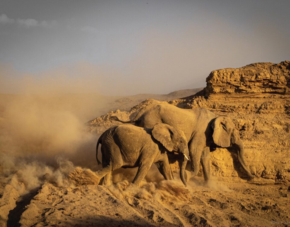
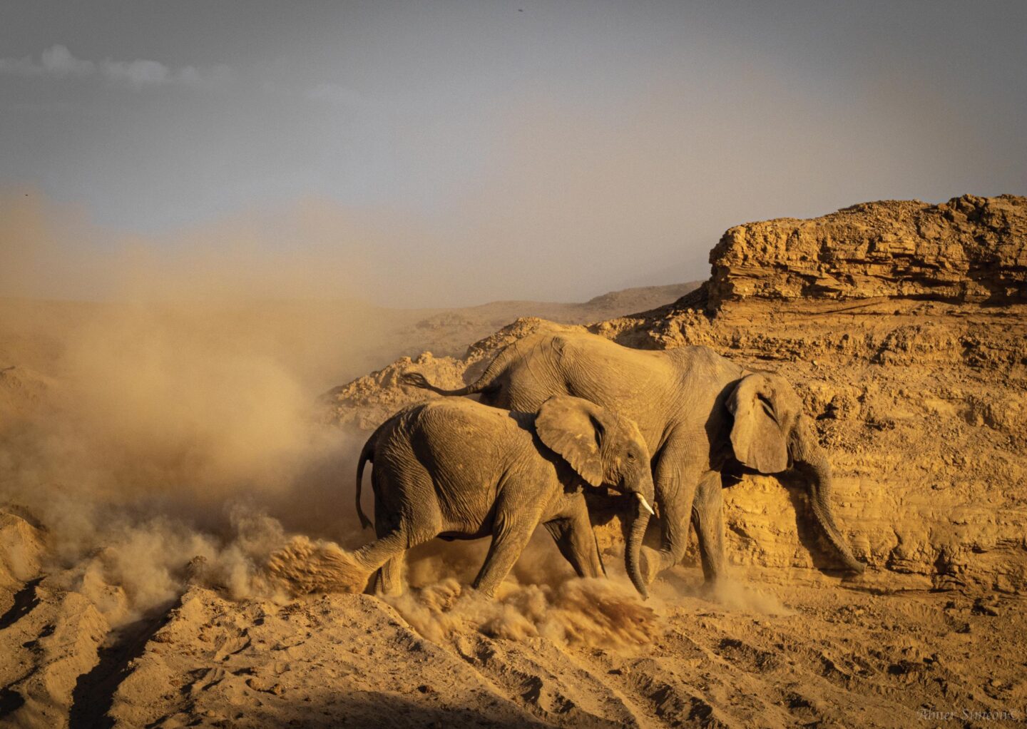
Tinkas area by Peter Bridgeford
Long before Andersson crossed the Namib, about 520 million years ago, in fact, magma from the earth’s core pushed upwards to form many of the mountains in Namibia. Over millennia erosion left hard, granite outcrops. One of them is Bloedkoppie (Blood Mountain), the name referring to its red colour, especially at sundown. Campsites have been constructed around this outcrop, reached approximately 105 kilometres after leaving Swakopmund on the C28. If you’re in a sedan car, choose a campsite on the southern or eastern side, as the ground is hard. Don’t be tempted to drive around to the back, where the sand is soft and your vehicle is likely to become bogged down. For visitors in 4×4 vehicles, there are several camping sites along the sandy watercourse. They are under trees and thus protected from the wind,
A visit is not complete without climbing Bloedkoppie, where sundowners can be enjoyed from the ‘top of the world’. To the north lies the site of the new uranium mine, Langer Heinrich Mountain, which glows at night (just joking, of course).
To reach the Rock Arch campsites, follow the road signs to Tinkas, where the surroundings have hardly changed since Andersson’s visit almost 160 years ago. For the energetic types, there is a short, interesting nature walk. It’s best to go in the early morning before it becomes hot. Remember to take your camera, at least two litres of water and, most importantly, your hat. Andersson suffered from sunstroke, which is unpleasant and dangerous, so remember his warning of ‘serious consequences’. Keep a lookout for the signboards indicating the start of the trail.
Driving along the track, you’ll pass the graves of two German soldiers (Schutztruppe) who built a well in the river, now filled by sand, not far from the ruins of their small, stone-built house. Stop for a moment and imagine what it must have been like living there a hundred years ago; they deserve a salute!
On a moonlit night, at the Rock Arch campsites, the dragons, gargoyles and Andersson’s ‘wild beasts’ are out in force. The eroded granite rocks resemble these primordial creatures and as the moon glides across the sky, they seem to come alive with the changing light. But be warned: this is not for the faint-hearted! Drive on (if you’ve survived the night) to the Tinkas Dam. In some rainy seasons, this unexpected construction is filled with water, which attracts water birds. At Bloedkoppie, on the western side, a wall impounds the water flowing off the bare granite. Occasionally it holds water and on a hot summer’s day, provides a delightfully cool dip.
Make sure you have enough fuel for your vehicle, firewood, plenty of potable water and, of course, cold Namibian beer!
Before venturing into this fascinating area, be sure to pay entrance fees and obtain a map and permit from the office of the Ministry of Environment and Tourism, either in Swakopmund (064 40 4576) or Walvis Bay (064 20 5971). You can contact the Namibia Wildlife Resorts reservation office in Windhoek at reservations@nwr.com.na
Other campsites in this part of the Namib-Naukluft Park are at the Kuiseb Bridge (along the C14), Homeb (Kuiseb River), Swakop River (en route to the Welwitschia Plains), Mirabib (between Gobabeb and the C14), Ganab, Vogelfederberg and Kriess-se-Rus.
![]() This article was made possible by Cymot Namibia
This article was made possible by Cymot Namibia
This article appeared in the Aug/Sep ‘07 edition of Travel News Namibia.