
Bird’s-eye view – Hartlaub’s Spurfowl
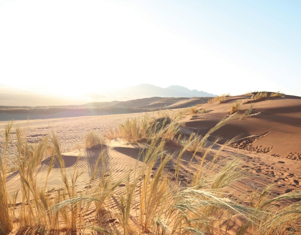
August 23, 2012Nubib Nature Camp
August 23, 2012A volcanic ruin of great beauty and diversity
by Luise Hoffmann
The vast open spaces so typical of the Namibian landscape are more often than not accentuated by distant blue mountains beckoning invitingly to travellers. Their attraction is perhaps due to an atavistic instinct telling us that mountains represent shelter, spring water, plant and animal diversity, and thus safety and food.
As you travel towards Karibib along the B2 on your way to the coast, the blue contours of the Erongo Mountains gradually rise out of the undulating plains on your right. About 20–30 km before reaching Karibib, you will see two distinctive hills on the left. One has a flat-topped box-like appearance and is locally known as Sargdeckel, meaning ‘coffin lid’. The other one is shaped like half a lemon and is called Jungfrau, meaning ‘virgin’, due to an anatomical similarity.

Round rock. Photo ©Luise Hoffmann
Now try to imagine what this part of the world must have looked like some 110 million years ago when – as the geologists tell us – the Erongo was 3 000 metres high and the lava and ashes it had spewed covered the land at least as far as Sargdeckel and Jungfrau, where their residues are still found today. This will give you an idea of the enormous upheavals that occurred in this part of the world where some of the oldest volcanic formations on earth lie exposed.
Onetime volcano
As you continue, the range grows larger. It can eventually be admired in its full majesty from the first lay-by between Karibib and Usakos. Stopping under the camel-thorn tree at this lay-by gives you the opportunity to fill your eyes with the great beauty of the mountain range, which by now dominates the view to the north-west.
Today’s Erongo is only a fraction of what was once a huge volcano. About 130 million years ago, shortly before the ancient continent of Gondwanaland began splitting up into South America, Africa, India, Antarctica and Australia, the crust of the earth in the vicinity of today’s Erongo massif cracked and heaved and the surrounding areas were flooded by streams of lava. The volcano remained active for the ensuing 20 million years, spewing forth enormous amounts of molten rock and huge clouds of ash, which killed all surrounding plant life.
After about 20 million years, so much matter had been flung out of the crater that a loss of mass occurred under its base. The volcano collapsed, forming a large caldera at its centre. This central flat area can be accessed only from the north, as it is almost completely surrounded by rugged cliffs and steep slopes.
Granite landscape
As the volcano collapsed, molten granitic magma was forced upwards into cracks and crevasses under and around the base of the subsiding mountain. However, this molten mass did not reach the surface, but solidified underground. This is why Erongo granite looks different from granite found in Europe and elsewhere. During the ensuing millennia, most of the overlying matter was eroded, exposing a ring of reddish granite around the older volcanic rock at the centre of the Erongo.
All major roads leading to Karibib and Usakos do so against the beautiful backdrop of the Erongo range. Even more fascinating when experienced from close up, Erongo is most easily accessible from Ameib Guest Ranch situated on the southern edge of the mountain.
Hiking in this kind of granite landscape is a wonderful experience. The extensive areas of smooth, undulating rock are comfortable to walk on. In contrast to many hiking trails in Namibia, there are no thorny shrubs, no sticky grass or burs and no dust. The smooth red mountainsides and intriguing piles of huge boulders are surrounded by lush and diverse plant growth, which is fed by run-off from the stone flats. Although serious mountaineering can be done on Ameib, you can almost always find an easy way to climb up many of the rocky outcrops and peaks to admire the wonderful view across the surrounding land.
Bull’s Party
Groups of huge spherical boulders will certainly attract your attention. The most well known of these are at Bull’s Party. Admiring the shapes and colours of these rocks, you might wonder how they were formed. Millions of years ago the rock on which you sit was molten magma welling up into underground cracks and crevasses formed as the volcano subsided. The magma solidified and, during wetter periods, water filtered into the earth, finding its way along natural lines of weakness, which then expanded and eventually broke up the rock into huge rounded chunks, known as ‘woolsack’ formations.
The rock at Ameib becomes exceedingly hot during the day. Yet, immediately after sunset, the heat is radiated into the cloudless atmosphere and temperatures drop dramatically. Over centuries the rock is weakened by expansion and contraction. Because this kind of magma cools in concentric layers, it weathers in layers similar to onion skins.
Flat, rounded ‘skins’ of stone resting atop their boulder of origin or lying shattered at its base can be seen everywhere. You will often find a spherical or oval rock split into two chunks, which would fit together like pieces of a gigantic three-dimensional puzzle. These are formed when the huge boulders heat up under the intense heat of the summer sun. Thunderclouds piling up in the thermals above the mountain often result in short heavy downpours of cold rain. The sudden drop in temperature sometimes causes one of these spherical rocks to split with an enormous boom.
Dust and debris collect in any cavity. Seeds germinate and you often find delicate little flowering plants perching on the steep wall of harsh rock. Runoff after sudden thunderstorms eats away at the rock surface around the base of the boulders, leaving many of them perched precariously on thin necks of stone.
Plan to arrive at Ameib around lunchtime or in the early afternoon and to stay overnight. Then you have the cooler hours of late afternoon and early morning to explore the landscape just before sunset or just after sunrise – which are the ‘golden hours’ for taking stunning photographs – or just to meditate on the great beauty of the area.
Reference: Namibia – Fascination of Geology by Gaby Schneider ISBN 999 16 747 80
This article appeared in the Dec ‘07/ Jan ‘08 edition of Travel News Namibia.