

How the Fish River Canyon Ran Over Me
September 21, 2018
Salvadora and the Strange Oasis
September 22, 2018[vc_row][vc_column][vc_column_text]
A unique conglomerate of species and geology.
[/vc_column_text][vc_column_text]Landscape-level conservation is a Travel News Namibia series aimed at raising awareness of this highly effective conservation outlook. The first article, an introduction to all five appointed landscapes in Namibia, was published in the 2018 Winter Edition of Travel News Namibia. As a NAMPLACE project, landscape conservation received government funding from 2011 to 2016. Despite this limited timeframe, the intention was for each landscape to take stock of what has been learned in a 5-year course and use it as building blocks to continue conservation on a big scale. However, certain challenges still remain.
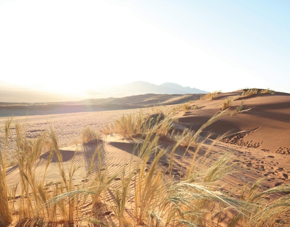
Annelien Robberts takes a look at landscape-level conservation of the Greater Fish River Canyon Landscape (GFRCL) with the Coordinator for Landscapes Conservation Areas, Monika Shikonga, who shares the success stories and talks about the obstacles and the way forward.[/vc_column_text][/vc_column][/vc_row][vc_row][vc_column width=”1/2″][vc_column_text]When talking to people who originate from the south, I often become aware of an undeniable nostalgia in their voices, which in itself tells a story about this land with its highly diverse landscapes and climatic extremes. The love of these people for the rugged landscape is deeper than the incised Orange River (less than 100 m) and higher than the Namuskluft Peak at 1 654 m above mean sea level.
Despite the fact that I come from the north, my heart also beats compassionately for this mosaic of diverse topographic features that makes up the GFRCL. It covers 7621 km², which means there is so much to love – from the Orange River in the south to the Naute Recreational Resort further north, from the Ai-Ais Hotsprings in the west (bordering the Sperrgebiet National Park) to the top of the Klein Karas Mountains in the east. The area incorporates /Ai-/Ais National Park (now also known as /Ai-/Ais-Richtersveld Transfrontier Park), the Naute Recreation Resort, private farms, private game reserves and a communal conservancy.[/vc_column_text][/vc_column][vc_column width=”1/2″][vc_single_image image=”54987″ img_size=”full” add_caption=”yes” alignment=”center”][/vc_column][/vc_row][vc_row][vc_column][vc_column_text]The landscape extends across two biomes, the Nama Karoo and the Succulent Karoo. It includes the largest single conservation area of the Succulent Karoo biome in Namibia, an ecosystem recognised as one of the 25 biological ‘hotspots’ of the world. An array of rocky and sandy plains, rocky hillsides, plateaus, drainage lines, incised valleys and ephemeral river courses characterise the GFRCL. In the course of its fascinating geological history some of the oldest rocks, over 2,000 million years old, were formed along the Orange River valley. According to Monika, some areas, especially those in the north-western part of the GFRCL in the inaccessible Huns Mountains, have remained relatively undisturbed by human intervention. By contrast, the areas adjacent to the Orange River and to the east and north of Ai-Ais National Park have been severely affected by mining and agriculture.
WHO ARE THE FOUNDING MEMBERS OF THE GREATER FISH RIVER CANYON LANDSCAPE (GFRCL)?
/Ai-/Ais National Park, Aussenkehr Nature Park, Canyon Nature Park, Canyon Private Nature Reserve, Gondwana Canyon Park, Klein Karas Community Cooperative, Naute Recreational Park (represented by MET), Ai-Ais Hotsprings Resort (Namibia Wildlife Resorts) and Hobas Resort (Namibia Wildlife Resorts).
SUCCESS STORIES: WORKING FROM THE BOTTOM UP
The GFRCL is a great example of collaborative stakeholders who realised the importance of working from the bottom up. This means that they firstly identified the people’s needs and used that as the get-go. For starters, the Klein Karas community greatly benefited from much-needed support in the form of a sewing project and a green garden project. Furthermore, shepherd dogs were introduced to protect the farming community’s livestock against predators.
Monika further explains, “They were also able to address the major issue of poaching, a ‘top’ problem, by improving radio communication, which is a ‘bottom’ element. This has also led to the more regular recording of game counts that are still on-going, which is extremely important in such vast spaces as it will help to identify other problems that need to be addressed. Another project worth mentioning is an annual clean-up campaign that still continues strongly.”Working from the not-so-glamorous bottom has its advantages. Although plants are relatively well studied in Namibia, keen botanists will be excited to know that new plant species have been discovered as a result of intensive surveys. This is thrilling news, as finding new species is not a daily event. Plus, range extensions generated new records of plants in areas where they have not been found previously.
Moreover, the improvement of the landscape’s ecological database has enabled the revision of the previous mapping for Ai-Ais National Park. Mountain areas could thus be divided into smaller landscape units, which facilitated more detailed descriptions. Some of the boundaries were also slightly adjusted. The point of all this is to pinpoint gaps in our knowledge of the biodiversity, which could help to channel further research.
THE FUTURE OF THE LANDSCAPE
The next step in the process is to revive the community. As Monika knows the significance of putting plans into action, a meeting between stakeholders is in the pipeline, so that the position of the landscape can be figured out, as well as funding for activities. She also highlights that all land-users need to be accommodated because it is the only way to ensure sustainability. The emphasis will remain on non-consumptive uses, sustainable land management practices, low impact tourism, environmental education, awareness and outreach initiatives and research, as well as to create strategic and focused economic opportunities without compromising on sound conservation principles and practices.
Once stakeholders have met, the research will continue in order to gain a deeper understanding of this ecosystem, since there is not enough data about species distribution on a landscape level yet. Monika acknowledges that there are a lot of things that should be taken into accounts, such as extremely low and spatially erratic rainfall in the area and local wildlife migration across vast distances as a survival strategy. Due to this, the removal of artificial barriers hampering the natural movement of wildlife within the GFRCL has to be considered. This will restore historic grazing and migration patterns. Eventually, plants and animals indigenous to the area can be reintroduced. All of this is possible, Monika explains if partners and neighbours collaborate and align management practices. There is also some exciting news… Sperrgebiet might soon be added to this successful landscape, which will potentially advance conservation in the country.
All in all, GFRCL has served as an example of smart public-private sector partnership and collaborative management between different members and across public and private land. We are excited to keep an eye on this landscape – a conservation norm setter in Namibia.[/vc_column_text][/vc_column][/vc_row][vc_row][vc_column][vc_column_text]
You might also enjoy reading: Nkasa Rupara National Park
[/vc_column_text][/vc_column][/vc_row][vc_row][vc_column][vc_column_text]
This article was first published in the Spring 2018 issue of TNN.
[/vc_column_text][/vc_column][/vc_row]